 Cart - 0
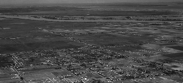
31
December
BO-47-1571 : Brighouse Overview
This is an overview of the Brighouse Race Track in Richmond from 1947.
Hello, it is with a heavy heart that I have to announce the upcoming shutdown of Vintage Air Photos. My hosting provider has increased rates for storage and the very large images this website uses now cost more in a month than the website makes per year. I will try to keep the website up for several more weeks but I imagine Vintage Air Photos will go offline mid-October. If there are any images you would like to keep viewing, now would probably be a good time to make a purchase. Thanks for all the views over the years.
This is an overview of the Brighouse Race Track in Richmond from 1947.
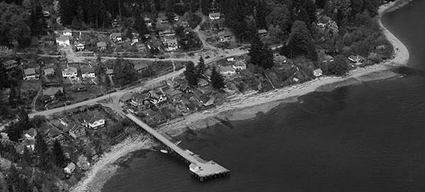
This is a close up of Granthams Landing, just north of Gibsons, from 1948. This image was originally mislabelled as Hopkins Landing. Thanks to Margo for pointing out the error.
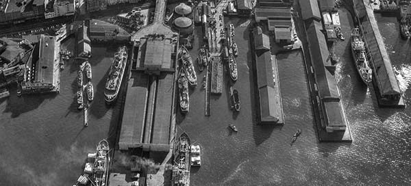
This is a nice photo of the Vancouver waterfront at the foot of Main Street from 1959. You get a nice view of the back of the Canadian National Pier.
This photo from 1947 covers the industrial area of Coquitlam near the Cape Horn Interchange. Needless to say, it’s barely recognizable. You can make out the railway tracks, with what may be Colony Farm in the upper-right. The street in the top-left corner is now Cape Horn Avenue, which I believe back then was still…
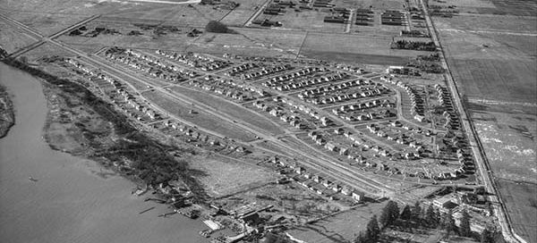
This is the community of Burkeville on Sea Island, in Richmond, from 1947. It was established in 1943 as a port of the Dominion Government’s Wartime Housing Plan. You can see the Vancouver Airport in the background.
This photo from 1947 is one of several labelled BC Livestock Exchange. I wasn’t able to find any information about the site, but interestingly, it was located at the foot of Fraser Street where the old Fraser Street Bridge went over to Mitchell Island.
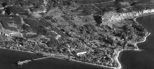
This is Naramata, on the east shore of Okanagan Lake, from 1948. Check out the rail barge bringing in supplies.
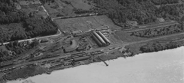
This is the CN Thornton Rail Yard from 1947. This active rail yard was located just west of the (now) Port Mann Bridge on the Surrey side of the river. Check out all the steam locomotives! In the top-right corner of the frame you can just make out King George Highway.
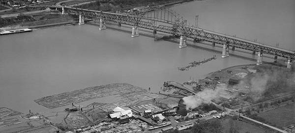
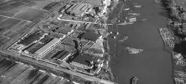
This is the Timberland Lumber Company Sawmill, located in the Brownsville area of Surrey, from 1948. The dock that you see near the sawmill, might very well be the remains of Surrey’s only ferry terminal. It operated between Surrey and New Westminster up until the late 1800’s. In the background, of course, is New Westminster.
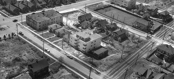
This is another low altitude shot of apartment buildings in the Kitsilano area of Vancouver from 1948. The intersection in the top-left is the corner of Cornwall Avenue and Maple Street. At the bottom of the image you can see the rail lines that the interurban streetcars ran on. The “Kitsilano Loop” was in use…