 Cart - 0
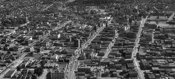
8
June
BO-47-1451 : Downtown Victoria
This is a slightly different view of Victoria from 1947. Looking south down Government and Douglas Streets from roughly Herald Street. You can see all the way to the ocean.
This is a slightly different view of Victoria from 1947. Looking south down Government and Douglas Streets from roughly Herald Street. You can see all the way to the ocean.
This is the area of Hastings Street and Clark Drive, in Vancouver, from 1947. The main street near the bottom of the image with the “S” curve in it is Hastings. You’ll notice several streetcars on Hastings. You can also just make our Commercial Drive near the top of the screen.
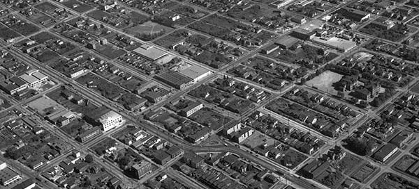
This is Hastings Street in Burnaby from 1947. The street at the bottom of the image running left/right is Ingleton Avenue. Off near the top of the image, you can see the building which is now the Confederation Community Center on Willingdon Avenue. You also get a good view of Pender and Albert Streets.
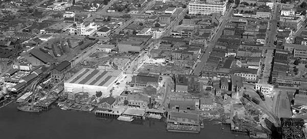
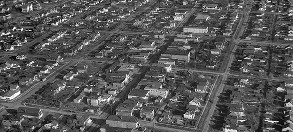
This is Victoria from 1947. The area just North/East of the Johnson Street Bridge. You get a nice view of Fisgard Street, Herald Street and Chatham Street.
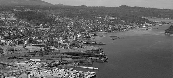
This is the Eureka Sawmill with the city of Nanaimo in the background from 1947.
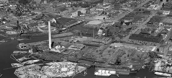
This is the Canadian Puget Sound Lumber Mill in Victoria from 1947. It’s located at the corner of Pembroke Street and Store Street.
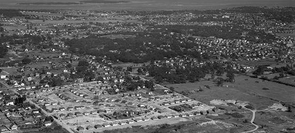
This is a subdivision in Victoria from 1947 that is under construction. The street running diagonally through the image from the left is Tolmie Avenue. The houses under construction are on Alder, Reed, Rutledge, Yew and Glasgow Streets.
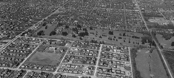
This is the Shaughnessy area of Vancouver from 1947. Old Shaughnessy Golf Course, near the center of the image, became the VanDusen Botanical Garden 28 years after this photo was taken. Vancouver College can be seen in just left and below the center of the image.
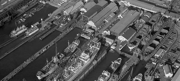
This is the Burrard Dry Dock site in North Vancouver from 1947. It was situated at the base of Lonsdale Avenue and built over 450 ships in 87 years. You can also see the North Vancouver Ferry Company before it became the SeaBus.