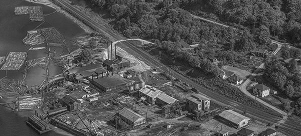
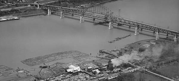
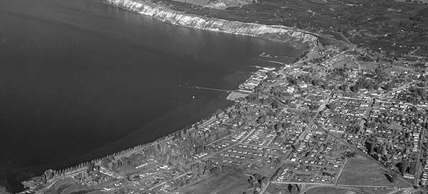
1948
BO-48-2809 : Kitsilano Apartments
This is a really low altitude shot of some apartments in Vancouver from 1948. The intersection is the corner of Cornwall Avenue and Vine Street just south of Kitsilano Beach Park. Surprisingly, the area still looks pretty similar.
BO-48-3535 : Penticton North Overview
This is an overview of the northern part of Penticton from 1948.
BO-48-3540 : Penticton Saw Mill
This is the Penticton Saw Mill and adjoining Kettle Valley Railway Station from 1948. The rail station was located on the west side of central Penticton between Hastings Avenue and Duncan Avenue West.
BO-48-3590 : Massey Tunnel Site
There is a bit of uncertainty with the exact location of this image, but it appears to be roughly the location of the George Massey Tunnel from November 22, 1948. It looks like the tunnel will end up going through the field in the lower-left corner of the image. Construction of the tunnel didn’t begin until 1957 and at that time it was known as the Deas Island Tunnel.
BO-48-2734 : Canada Creosoting Ltd.
This is an image of Canada Creosoting Company Ltd in North Vancouver from 1948. The mill was located just west of what is now the North Shore Auto Mall. The entire area has yet to be filled in. You can see the water runs right up to the railway tracks near 1st Avenue.
BO-48-3305 : Keith Road, North Vancouver
This is Keith Road West in North Vancouver from 1948. The two cross streets are Forbes Avenue and Jones Avenue. You can see the St. Thomas Aquinas Regional Secondary School in the lower-left corner and Mahon Park in the background.
BO-48-3306 : J.P. Fell Armoury
This is Mahon Park and the Lt. Col. J.P. Fell Armoury in North Vancouver from 1948. For reference, Mahon Park is located at the corner of Jones Avenue and West 16th Street.
BO-48-3089 : The Mission Region Flood
This is a higher altitude shot of the area east of Mission during the big flood of 1948. The flood affected Nicomen Island, Deroche, Dewdney, Dewdney Peninsula, Hatzic and Mission Flats. A total of 13,135 acres of agricultural land were flooded by the Fraser with 514 houses lost to flood waters.
BO-48-3091 : Fort Langley Flood
This is a higher altitude shot of Fort Langley during the big flood of the Fraser River in 1948. Water completely surrounded the city and Fort Langley was cut off from the rest of the world for almost two weeks.


