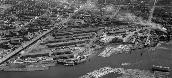
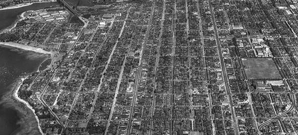
55-63 : Cambie Street Bridge South

 This is a view of the south end of the Cambie Street Bridge from 1955. You can see a good chunk of the Mt. Pleasant and Fairview areas of Vancouver all the way back to Queen Elizabeth Park. The photo itself is labelled “Johnson Storage” but I was unable to find any information about the…

BO-48-3590 : Massey Tunnel Site

 There is a bit of uncertainty with the exact location of this image, but it appears to be roughly the location of the George Massey Tunnel from November 22, 1948. It looks like the tunnel will end up going through the field in the lower-left corner of the image. Construction of the tunnel didn’t begin…

57-60 : Mary Hill Bypass

 This is the location of the Mary Hill Bypass in Port Coquitlam from 1957. Interestingly, the City of Port Coquitlam claims that the Evans Coleman and Evans aggregate gravel plant did not open here until August of 1960, but this photo from 1957 clearly shows a working plant. The Mary Hill Bypass itself did not…

56-144 : Lions Gate Toll Booths

 These are the toll booths at the North end of the Lions Gate Bridge from 1956. Welch Street is at the bottom with Mathias Road on the right. The tolls remained on the bridge until 1963.

54-30 : Gibbons Drive, Richmond

 This is Gibbons Drive in Richmond from 1954, approximately where James Thompson Elementary School now sits. The intersection at the very top of the image is No. 1 Road and Granville Avenue.

55-26 : Vancouver Collingwood

 This is the Collingwood area of Vancouver from 1955. The main street near the bottom of the image is East 41st Ave and the street on the left running up/down with the “zig-zag” in it is Nanaimo Street.

58-49 : Station Square Burnaby

 This is the Station Square area of Burnaby from 1958. You get a great view of the Ford Motor Plant, which has several of it’s own posts. The major street just below the Ford Plant is Kingsway. To the right of the Ford Plant you see Silver Avenue, McKay Avenue and Willingdon Avenue.