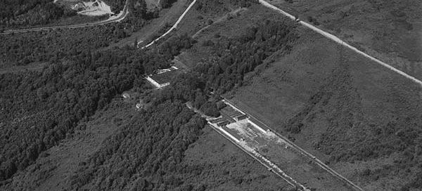
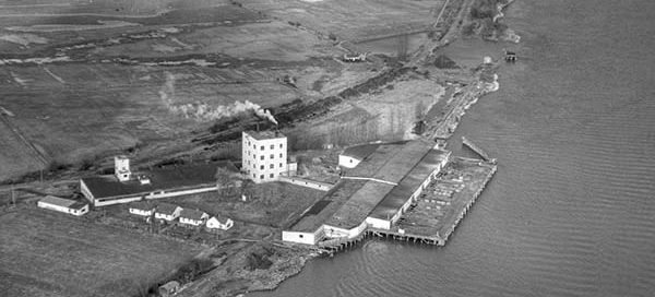
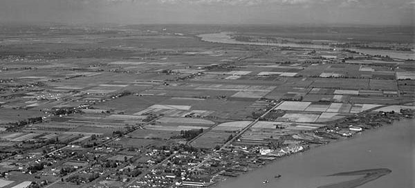
BO-47-1632 : Coquitlam Industrial

 This photo from 1947 covers the industrial area of Coquitlam near the Cape Horn Interchange. Needless to say, it’s barely recognizable. You can make out the railway tracks, with what may be Colony Farm in the upper-right. The street in the top-left corner is now Cape Horn Avenue, which I believe back then was still…

BO-52-275 : Strathcona

 These are the docks in the Strathcona area of Vancouver from 1952. The main building in the center-top of the photo is the American Can Factory. You also get a great view of the railyards, Ballantyne Pier and the surrounding neighborhood. Some of the streets in this image are Powell Street, East Cordova Street, East…

1-171 : Kelowna, Knox Mountain

 This is a view of the Knox Mountain in the North End area of Kelowna from 1951. Some of the streets in the image are Wilson Ave, Cawston Ave, Coronation Ave, Clement Ave and Ethel Street.

BO-48-3590 : Massey Tunnel Site

 There is a bit of uncertainty with the exact location of this image, but it appears to be roughly the location of the George Massey Tunnel from November 22, 1948. It looks like the tunnel will end up going through the field in the lower-left corner of the image. Construction of the tunnel didn’t begin…

BO-47-845 : Jericho Beach (High Altitude)

 This is a “high altitude” view of the Jericho Beach Air Station from 1947. I haven’t been posting any of the higher altitude photos because you can’t see much ground detail, but this was a special request. It seems to be the only photo that shows the entire Air Station. You also get a unique…

59-241 : Tsawwassen Ferry Terminal

 This is Tsawwassen Ferry Terminal under construction from November 4, 1959. An artificial island was built and the causeway was constructed from the island back towards the mainland. This endeavour used an estimated 3.0 million cubic yards of boulder, rock and gravel fill.