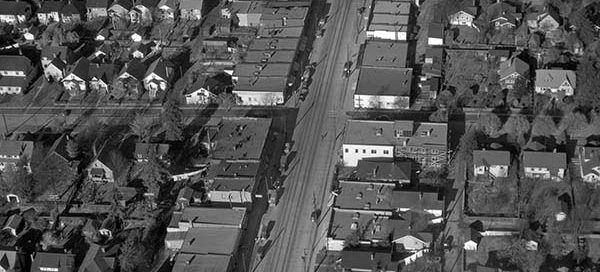
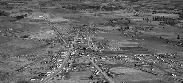
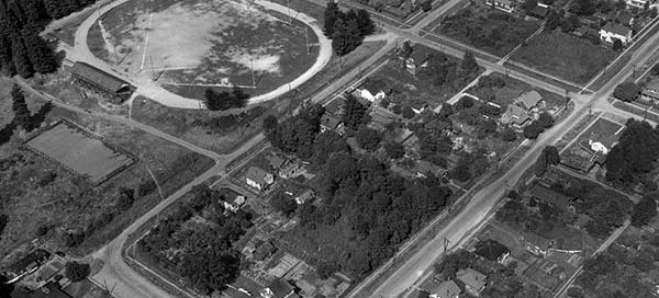
BO-47-2544 : Dunbar Street

 This is a view up Dunbar Street in the Dunbar-Southlands area of Vancouver from 1947. The cross-street at the bottom of the image is West 28th Avenue and the street at the top of the image is West King Edward Avenue.

BO-47-2451 : Wreck of the “Gulf Stream”

 During a heavy storm in October 1947, the passenger ship Gulf Stream ran aground on Dinner Rock, approximately 18km north-west of Powell River. Five of the 36 people on-board were killed. The ship sat on the rock for three weeks until it slipped into deeper waters.

BO-54-161 : Langley Prairie

 This is Langley Prairie, part of the Township of Langley, from 1954. A year later the city incorporated as a separate municipality and it became known as the City of Langley.

BO-47-2585 : Vancouver Airport / Boeing Plant

 This the Vancouver Airport from 1947 looking south-east towards the Boeing Plant. In 1939 Boeing built a huge manufacturing factory on Sea Island to build aircraft for the war effort. Following Japan’s surrender at the end of the Second World War, the plant immediately closed leaving 7,000 workers stunned and scrambling for work.

BO-47-2588 : The Airport in Vancouver

 This is the Vancouver Airport main terminal from 1947. Through the 1940’s the airport was actually more of a military base which the city leased out to the Federal Government. In 1947, the city of Vancouver resumed control of the airport and begun serving a number of airlines. A year later in 1948, the airport…

BO-47-2660 : Arbutus Market

 This photo was labelled “Market Basket at 16th and Arbutus” and shows a market under construction from 1947. You also get a great view of the surrounding neighbourhood.

Google Earth View Added

We’re excited to announce a new feature today which allows you to open a similar view of a vintage image in Google Earth. Now you can see how an area looks today and compare it to the historical image. At the bottom of the Zoom window, you’ll find a link to open the similar view…

BO-48-3089 : The Mission Region Flood

 This is a higher altitude shot of the area east of Mission during the big flood of 1948. The flood affected Nicomen Island, Deroche, Dewdney, Dewdney Peninsula, Hatzic and Mission Flats. A total of 13,135 acres of agricultural land were flooded by the Fraser with 514 houses lost to flood waters.