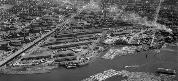
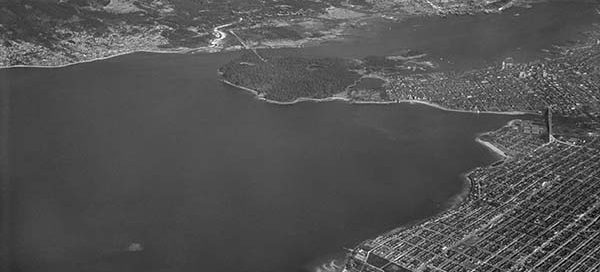
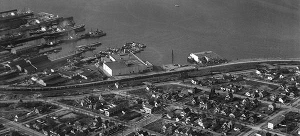
Vancouver
BO-56-364 : Grandview and Renfrew
This is the area of Grandview Highway in Vancouver from 1956. The street running left/right at the bottom of the image is Renfrew Street and we’re looking back towards Burnaby. It’s amazing how much this industrial area has changed.
55-49 : The End of the Interurban
This photo from 1955 provides an amazing view of the area around the Burrard Bridge. The Interurban electric railway system had ended and many of the trams were parked under the bridge waiting to be destroyed. The Molson brewery was still the Sicks’ Capilano Brewery, the old railway bridge still goes over False Creek, and the Seaforth Armoury is looking pretty quiet.
55-51 : Coal Harbour Shipping
This is Coal Harbour in Vancouver from 1955. A cool view of the shipping and rail activity going on in the area. The only tall building in the area is the Marine Building on Burrard Street.
BO-47-2585 : Vancouver Airport / Boeing Plant
This the Vancouver Airport from 1947 looking south-east towards the Boeing Plant. In 1939 Boeing built a huge manufacturing factory on Sea Island to build aircraft for the war effort. Following Japan’s surrender at the end of the Second World War, the plant immediately closed leaving 7,000 workers stunned and scrambling for work.
57-219 : McCleery Golf Course
This chunk of farmland will be the site of the McCleery Golf Course in the Kerrisdale area of Vancouver. The image is from 1957 and the course opened in 1959.
BO-47-2588 : The Airport in Vancouver
This is the Vancouver Airport main terminal from 1947. Through the 1940′s the airport was actually more of a military base which the city leased out to the Federal Government. In 1947, the city of Vancouver resumed control of the airport and begun serving a number of airlines. A year later in 1948, the airport was officially named the Vancouver International Airport.
BO-47-2660 : Arbutus Market
This photo was labelled “Market Basket at 16th and Arbutus” and shows a market under construction from 1947. You also get a great view of the surrounding neighbourhood.
58-3 : False Creek Fish Docks
This is a photo of the Fish Docks on False Creek. It was taken on February 13, 1958. You can still see the railway bridge that went over False Creek, the back of the Seaforth Armoury and part of the rail yards under the Burrard Street Bridge.
0-29 : The Kerrisdale Arena
The Kerrisdale Arena in Vancouver, also known as the Cyclone Taylor Arena, officially opened November 11, 1949. This photo from early 1950 shows off the new arena and the surrounding neighbourhood. Located at West 41st Avenue and East Boulevard, the skating facility was also the site of many concerts including a 1956 visit by Bill Haley and the Comets.


