 Cart - 0
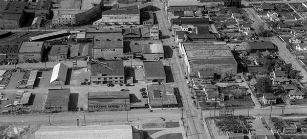
31
January
1-170 : Kelowna Grower’s Exchange
These are part of the Kelowna Grower’s Exchange buildings in downtown Kelowna from 1951. The main intersection in the image is the corner of Ellis St. and Doyle Ave.
Hello, it is with a heavy heart that I have to announce the upcoming shutdown of Vintage Air Photos. My hosting provider has increased rates for storage and the very large images this website uses now cost more in a month than the website makes per year. I will try to keep the website up for several more weeks but I imagine Vintage Air Photos will go offline mid-October. If there are any images you would like to keep viewing, now would probably be a good time to make a purchase. Thanks for all the views over the years.
These are part of the Kelowna Grower’s Exchange buildings in downtown Kelowna from 1951. The main intersection in the image is the corner of Ellis St. and Doyle Ave.
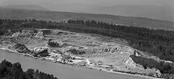
This is the location of the Mary Hill Bypass in Port Coquitlam from 1957. Interestingly, the City of Port Coquitlam claims that the Evans Coleman and Evans aggregate gravel plant did not open here until August of 1960, but this photo from 1957 clearly shows a working plant. The Mary Hill Bypass itself did not…
These are the toll booths at the North end of the Lions Gate Bridge from 1956. Welch Street is at the bottom with Mathias Road on the right. The tolls remained on the bridge until 1963.
As you may have read in our Background Information, there are three flight index books which contain descriptions of all of the photographs. In the past, when someone requests a particular area, I would have to flip through hundreds of handwritten pages hoping to find keywords that might indicate I was in the right area. Now,…
This is Gibbons Drive in Richmond from 1954, approximately where James Thompson Elementary School now sits. The intersection at the very top of the image is No. 1 Road and Granville Avenue.

This is the Collingwood area of Vancouver from 1955. The main street near the bottom of the image is East 41st Ave and the street on the left running up/down with the “zig-zag” in it is Nanaimo Street.
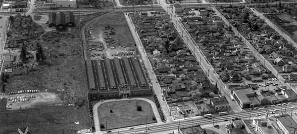
This is the Station Square area of Burnaby from 1958. You get a great view of the Ford Motor Plant, which has several of it’s own posts. The major street just below the Ford Plant is Kingsway. To the right of the Ford Plant you see Silver Avenue, McKay Avenue and Willingdon Avenue.