 Cart - 0
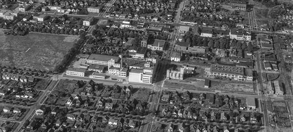
26
February
1-14 : The Old Carling Brewery North
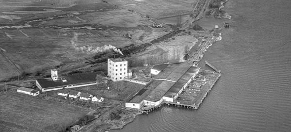
This photo from 1951 shows the Old Carling Brewery looking north towards Kitsilano Beach Park. The brewery was located at the corner of West 12th Avenue and Arbutus Street in Vancouver.
Hello, it is with a heavy heart that I have to announce the upcoming shutdown of Vintage Air Photos. My hosting provider has increased rates for storage and the very large images this website uses now cost more in a month than the website makes per year. I will try to keep the website up for several more weeks but I imagine Vintage Air Photos will go offline mid-October. If there are any images you would like to keep viewing, now would probably be a good time to make a purchase. Thanks for all the views over the years.
This photo from 1951 shows the Old Carling Brewery looking north towards Kitsilano Beach Park. The brewery was located at the corner of West 12th Avenue and Arbutus Street in Vancouver.
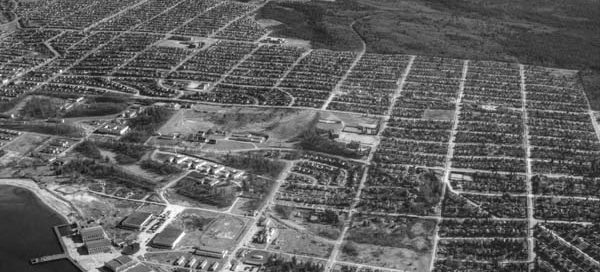
This is a slightly higher altitude overview of the West Point Grey area of Vancouver from 1955. You can see from Spanish Banks all the way back to the Vancouver Airport, and you get a nice view of all the buildings that make up the Jericho Beach Air Station.
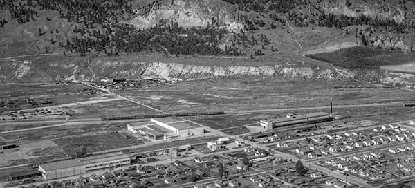
This is a view of the Knox Mountain in the North End area of Kelowna from 1951. Some of the streets in the image are Wilson Ave, Cawston Ave, Coronation Ave, Clement Ave and Ethel Street.
This is a view of the south end of the Cambie Street Bridge from 1955. You can see a good chunk of the Mt. Pleasant and Fairview areas of Vancouver all the way back to Queen Elizabeth Park. The photo itself is labelled “Johnson Storage” but I was unable to find any information about the…
There is a bit of uncertainty with the exact location of this image, but it appears to be roughly the location of the George Massey Tunnel from November 22, 1948. It looks like the tunnel will end up going through the field in the lower-left corner of the image. Construction of the tunnel didn’t begin…
Well, it turns out that our “seamless” move from one web hosting provider to another didn’t turn out quite as trouble-free as I would have liked. After some modifications we were able to get the site back online, but the Google Earth view feature is no longer working. For now, we have disabled the Google…
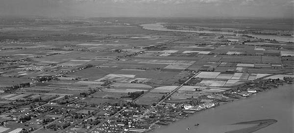
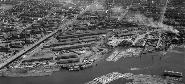
This is an overview of the fishing village of Steveston from 1947.