 Cart - 0
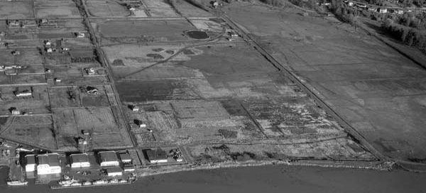
23
September
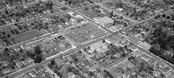
57-219 : McCleery Golf Course
This chunk of farmland will be the site of the McCleery Golf Course in the Kerrisdale area of Vancouver. The image is from 1957 and the course opened in 1959.
This chunk of farmland will be the site of the McCleery Golf Course in the Kerrisdale area of Vancouver. The image is from 1957 and the course opened in 1959.
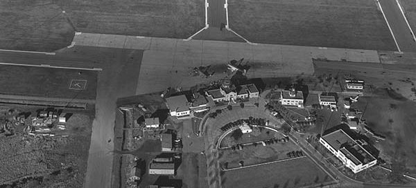
This is the Vancouver Airport main terminal from 1947. Through the 1940’s the airport was actually more of a military base which the city leased out to the Federal Government. In 1947, the city of Vancouver resumed control of the airport and begun serving a number of airlines. A year later in 1948, the airport…
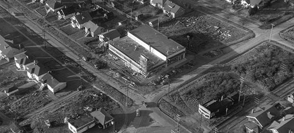
This photo was labelled “Market Basket at 16th and Arbutus” and shows a market under construction from 1947. You also get a great view of the surrounding neighbourhood.
This is Mahon Park and the Lt. Col. J.P. Fell Armoury in North Vancouver from 1948. For reference, Mahon Park is located at the corner of Jones Avenue and West 16th Street.
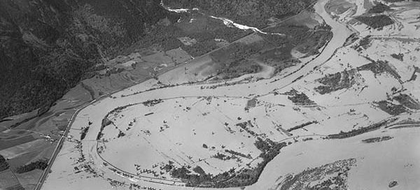
This is a higher altitude shot of the area east of Mission during the big flood of 1948. The flood affected Nicomen Island, Deroche, Dewdney, Dewdney Peninsula, Hatzic and Mission Flats. A total of 13,135 acres of agricultural land were flooded by the Fraser with 514 houses lost to flood waters.
This is a shot of the “stand-alone” Woodwards in New Westminster from 1956. The store was only two years old when this photo was taken. It was torn down in 1991 to make room for Royal City Center Mall.
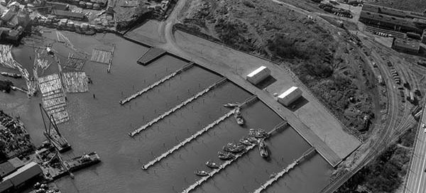
This is a photo of the Fish Docks on False Creek. It was taken on February 13, 1958. You can still see the railway bridge that went over False Creek, the back of the Seaforth Armoury and part of the rail yards under the Burrard Street Bridge.
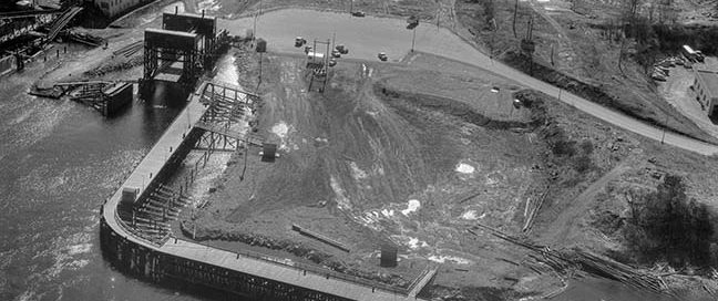
This is the CPR Wellcox Yard and Car Ferry Dock in Nanaimo from 1956. You can see remains of the dock are still there today.
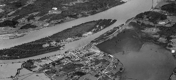
This is a higher altitude shot of Fort Langley during the big flood of the Fraser River in 1948. Water completely surrounded the city and Fort Langley was cut off from the rest of the world for almost two weeks.
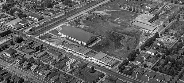
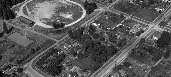
The Kerrisdale Arena in Vancouver, also known as the Cyclone Taylor Arena, officially opened November 11, 1949. This photo from early 1950 shows off the new arena and the surrounding neighbourhood. Located at West 41st Avenue and East Boulevard, the skating facility was also the site of many concerts including a 1956 visit by Bill…