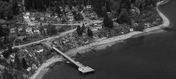
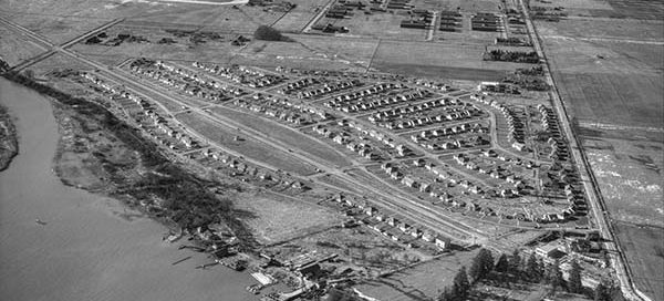
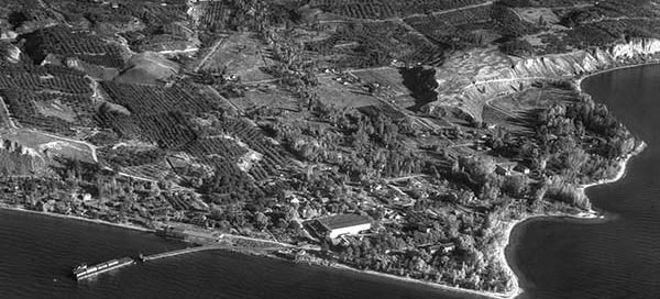
BO-50-54 : Capilano Highlands

 This is the Capilano Highlands area of North Vancouver from 1950. To give you a rough idea of where we are, Paisley Road falls near the center of the image. It’s very likely that the Capilano Suspension Bridge is actually toward the top-left corner, but is hidden behind all the trees.

Major Website Update

Hi everyone, there have been some pretty major changes to the Vintage Air Photos website over the past few days. The site has a new look, an updated zoom plugin which no longer pops up a new window, an updated store front, the star rating system has been updated, the highest rated image list has been…

BO-51-244 : Capilano Stadium Opening

 This is the Capilano Stadium from June 16, 1951. You probably know it better by it’s current name, the Nat Bailey Stadium. The stadium originally opened for business in 1951, but I was unable to find the exact date. From this view, the grounds around the stadium don’t appear to be complete yet.

BO-47-1632 : Coquitlam Industrial

 This photo from 1947 covers the industrial area of Coquitlam near the Cape Horn Interchange. Needless to say, it’s barely recognizable. You can make out the railway tracks, with what may be Colony Farm in the upper-right. The street in the top-left corner is now Cape Horn Avenue, which I believe back then was still…

BO-47-650 : Burkeville, Sea Island

 This is the community of Burkeville on Sea Island, in Richmond, from 1947. It was established in 1943 as a port of the Dominion Government’s Wartime Housing Plan. You can see the Vancouver Airport in the background.

BO-47-623 : BC Livestock Exchange

 This photo from 1947 is one of several labelled BC Livestock Exchange. I wasn’t able to find any information about the site, but interestingly, it was located at the foot of Fraser Street where the old Fraser Street Bridge went over to Mitchell Island.