 Cart - 0
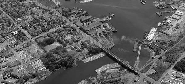
4
July
BO-54-152 : Bay St. Bridge Victoria
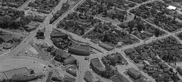
This is the Bay Street Bridge area in Victoria from 1954.
Hello, it is with a heavy heart that I have to announce the upcoming shutdown of Vintage Air Photos. My hosting provider has increased rates for storage and the very large images this website uses now cost more in a month than the website makes per year. I will try to keep the website up for several more weeks but I imagine Vintage Air Photos will go offline mid-October. If there are any images you would like to keep viewing, now would probably be a good time to make a purchase. Thanks for all the views over the years.
This is the Bay Street Bridge area in Victoria from 1954.
The is the Park Royal Mall in West Vancouver from 1950. The North Mall is under construction. The South Mall isn’t there yet. You can also see the bridge over the Capilano River and Lions Gate Bridge in the background.
This is the Burnside area of Victoria, looking south, from 1951. On the left, just above center, you can see the intersections of Gorge Road East, Douglas Street, Government Street and Hillside Avenue coming together in a traffic circle.
This is the area of Hastings Street and Clark Drive, in Vancouver, from 1947. The main street near the bottom of the image with the “S” curve in it is Hastings. You’ll notice several streetcars on Hastings. You can also just make our Commercial Drive near the top of the screen.
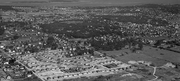
This is a subdivision in Victoria from 1947 that is under construction. The street running diagonally through the image from the left is Tolmie Avenue. The houses under construction are on Alder, Reed, Rutledge, Yew and Glasgow Streets.
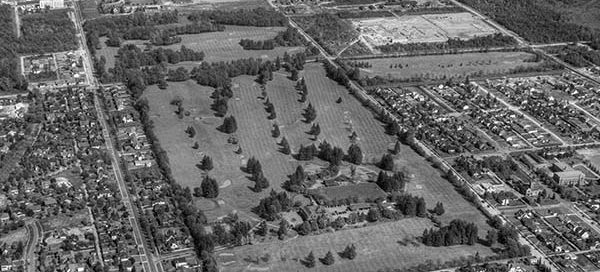
This is the Shaughnessy area of Vancouver from 1948. Old Shaughnessy Golf Course is now the site of the VanDusen Botanical Garden. There’s an interesting “camp” at the top of the image that looks like a military base. I count approximately 80 buses in the parking lot. If anyone has any information about this, please…
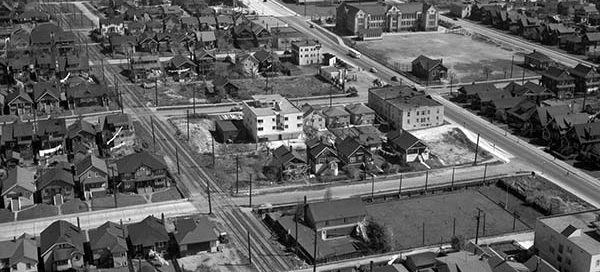
This is a low altitude photo of the Kitsilano area of Vancouver in 1948. You can see Henry Hudson Elementary (100 years old) just toward the top-right of center. Then two buildings further back lies the Seaforth Armoury.
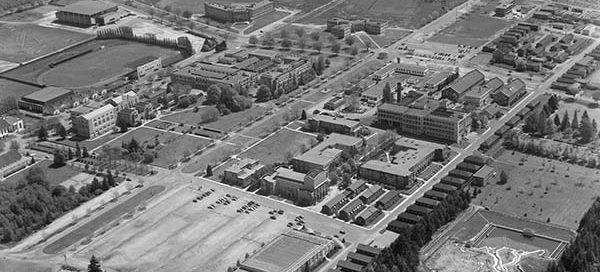
University of British Columbia from 1953.